From a county's PDF to a ranked shortlist
This is what you actually work in. No exports to spreadsheets, no twelve tabs of county websites — the research is already done when the list loads.
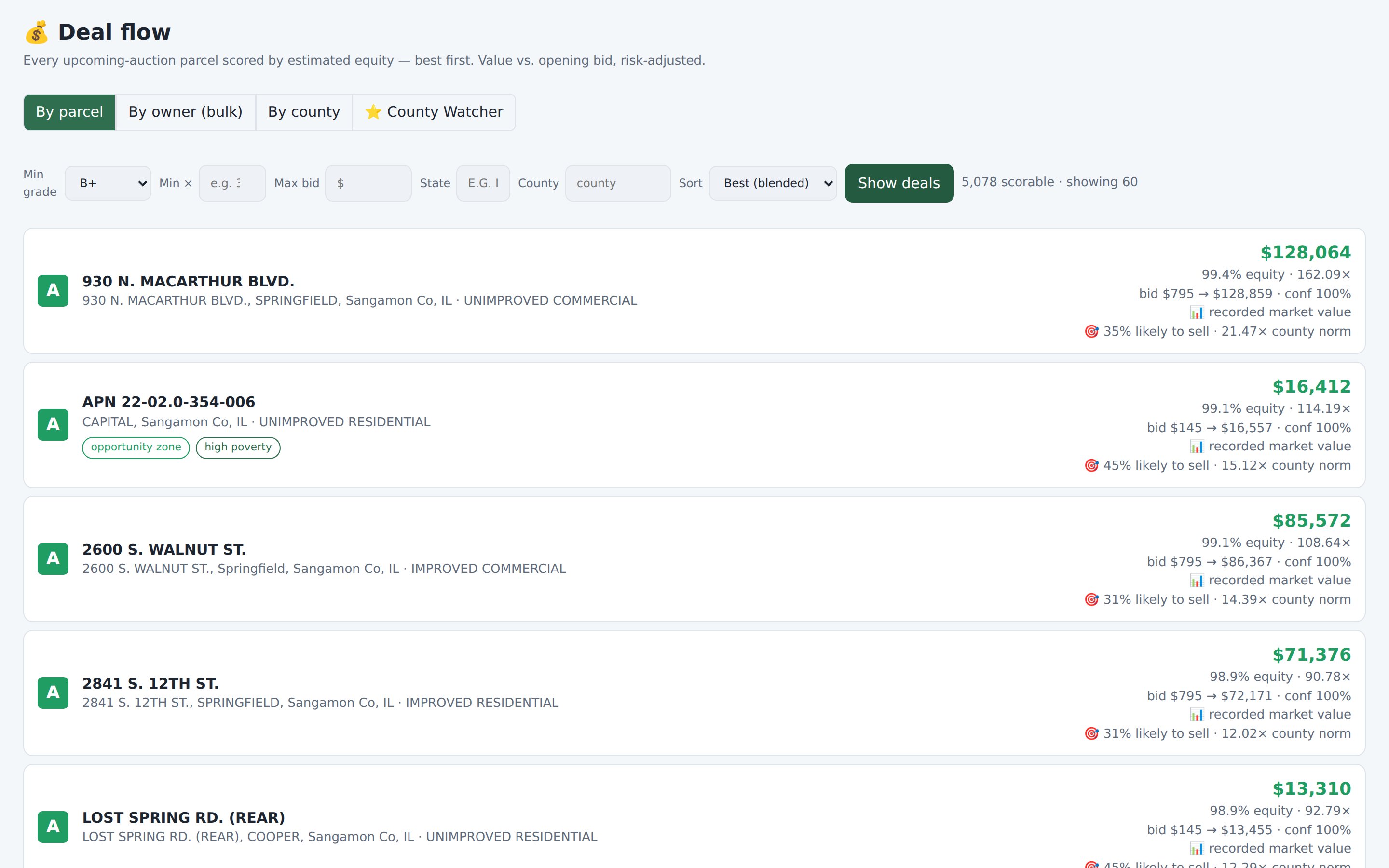
Open the Deals list. Start at the top.
Every lot from every tracked sale, graded and ranked in one list — by parcel, by owner, or by county.
- Grade, spread, and multiple on every row — the why, not just a score
- Filter by grade, max bid, value multiple, state, county
- Owner mode surfaces bulk and distressed-owner situations
- County mode tells you which sales are worth the trip
Click a lot. Know everything.
The parcel page is the whole knowledge file: what the county assesses, what our model thinks it's worth, what the risks are, and what survives the sale.
- Assessor record & true boundary — values, land use, acreage, geometry on the map
- Risk & context — flood zone, terrain, soils, EPA neighbors, neighborhood stats
- Owner & portfolio — who holds it and what else they hold
- Lien survival — the catch, printed on the page
- One-click research links — assessor, maps, street view, comps
Auction calendar & alerts
Upcoming sale dates in one calendar, and alert rules — grade, spread, geography, owner — that fire the moment a matching lot lands.
Map & saved views
Browse inventory on a map with true parcel boundaries, save the searches you run every week, and export any list to CSV or GeoJSON.
Built for a team
Shared notes, flags, and bid decisions on every lot, county watchlists, and seats for partners — so two of you never research the same parcel twice.